Remote Sensing Certification
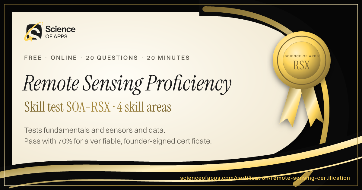
Tests remote sensing — gathering information about the Earth from satellite and airborne sensors — for GIS analysts, earth scientists and surveyors. Covers the fundamentals (the electromagnetic spectrum, reflectance, passive and active sensors, platforms and the four resolutions), sensors and data (optical, multispectral, hyperspectral, thermal, radar/SAR and LiDAR, plus Landsat and Sentinel), image processing (corrections, band combinations, spectral indices and classification), and applications and analysis. Written to NASA Earthdata, USGS and ASPRS references for 2026. Pass to earn Remote Sensing Proficiency SOA-RSX.
- Intermediate difficulty.Assumes hands-on experience in the role.
- 20 scenario questions
- 20 minutes, timed
- 70% to pass · 90% for distinction
- Free no sign-up needed
- LinkedIn-ready · add it to your profile in one clickSee how ↓

 Founder, Science of Apps
What is the Remote Sensing Certification?
- Career Booster
- Quality Assured
- Exclusive Certification
Updated for 2026 and 2027. Covers fundamentals, sensors and data, image processing and applications and analysis.
The Remote Sensing Certification is a free intermediate-level, 20-minute skill test from Science of Apps. It tests remote sensing — gathering information about the Earth from satellite and airborne sensors — for GIS analysts, earth scientists and surveyors. Covers the fundamentals (the electromagnetic spectrum, reflectance, passive and active sensors, platforms and the four resolutions), sensors and data (optical, multispectral, hyperspectral, thermal, radar/SAR and LiDAR, plus Landsat and Sentinel), image processing (corrections, band combinations, spectral indices and classification), and applications and analysis. Written to NASA Earthdata, USGS and ASPRS references for 2026. Score 70% or more on its 20 questions to earn a verifiable Remote Sensing Proficiency certificate (SOA-RSX). Every question is based on published standards and research — including Remote sensing backgrounder (NASA Earthdata), American Society for Photogrammetry and Remote Sensing (ASPRS), Copernicus Sentinel missions (European Space Agency) — and each answer is explained with its source.
Built for your job title
GIS or geospatial analyst, Earth or environmental scientist, Surveyor or mapping professional, Agriculture or forestry analyst and Remote sensing student — and anyone who wants quick, verifiable proof of Remote Sensing knowledge for a CV or LinkedIn in 2026 and 2027.
- GIS or geospatial analyst
- Earth or environmental scientist
- Surveyor or mapping professional
- Agriculture or forestry analyst
- Remote sensing student
What the test covers
Four skill areas with 5 questions each, drawn from a bank of 10 per area, so a retake brings questions you haven't seen.
Fundamentals
25%- Spectrum
- Sensors
- Resolution
Sensors and Data
25%- Optical
- Radar
- Satellites
Image Processing
25%- Correction
- Indices
- Classification
Applications and Analysis
25%- LandCover
- Change
- Accuracy
Independent skills test. Science of Apps is not affiliated with, endorsed by or sponsored by Science of Apps. Exam, product and organisation names are trademarks of their owners. Passing earns a Science of Apps certificate, not a credential issued by Science of Apps.
Based on published standards
The questions are original scenarios, and each one names the public standard, official guide or research it draws on — shown under the question while you answer, and linked in your review. These are the sources behind this test:
Try a sample question
A sensor that supplies its own energy, such as radar, is called
- a passive sensor
- a paper map
- an active sensor
- a spreadsheet
Show the answer
C. an active sensor — Sensors. The real test has 20 questions like this.
How the test works
20 minutes, 20 questions
One question per screen, with a progress bar and a countdown. Your progress is saved on this device if you need to pause.
Graded on our server
Answers reach the page only after you submit, so the certificate can only be earned by passing.
Every answer explained
Pass or not, you see every question with the right answer, why, and the source behind it. Pass mark 70%, distinction 90%.
Your certificate
Founder-signed, with a QR code and credential ID. Download PDF or PNG, add to LinkedIn, and it's emailed to you.
What you earn
Pass, then add it to LinkedIn in one click
No typing. The Add to LinkedIn button opens your profile’s Licenses & certifications form already filled in: the certificate name, Science of Apps as the issuer, the issue date, your credential ID and a link recruiters can use to verify it.
- 1Take the 20-minute test
- 2Score 70% or more
- 3Click Add to LinkedIn

Remote Sensing Proficiency
Science of Apps
Show credential ↗Try another skill test
- ProfessionalSOA-PA
Product Analytics Certification
Certifies that you can turn product data into decisions — metrics and instrumentation, funnels and conversion, retention and cohorts, and A/B testing and statistics.
Difficulty: AdvancedEarn Certified Product Analyst → - 10 minSOA-DLIT
Data Literacy Certification
Tests the everyday ability to read, question and communicate with data — chart reading, averages and percentages, data sources, bias and drawing sound conclusions.
Difficulty: BeginnerTake the 10-minute test → - 10 minSOA-XLF
Microsoft Excel Certification Test (Fundamentals)
Tests core Excel skills — cell references, essential formulas, sorting and filtering, tables, basic charts, conditional formatting and PivotTables.
Difficulty: BeginnerTake the 10-minute test →
Frequently asked questions
What is the Remote Sensing Certification?
The Remote Sensing Certification is a free intermediate-level, 20-minute skill test from Science of Apps. It tests remote sensing — gathering information about the Earth from satellite and airborne sensors — for GIS analysts, earth scientists and surveyors. Covers the fundamentals (the electromagnetic spectrum, reflectance, passive and active sensors, platforms and the four resolutions), sensors and data (optical, multispectral, hyperspectral, thermal, radar/SAR and LiDAR, plus Landsat and Sentinel), image processing (corrections, band combinations, spectral indices and classification), and applications and analysis. Written to NASA Earthdata, USGS and ASPRS references for 2026. Score 70% or more on its 20 questions to earn a verifiable Remote Sensing Proficiency certificate (SOA-RSX). Every question is based on published standards and research — including Remote sensing backgrounder (NASA Earthdata), American Society for Photogrammetry and Remote Sensing (ASPRS), Copernicus Sentinel missions (European Space Agency) — and each answer is explained with its source.
Where can I take a free Remote Sensing test online?
Science of Apps offers a free Remote Sensing Certification, updated for 2026 and 2027. It measures fundamentals, sensors and data, image processing and applications and analysis and gives instant results with a shareable certificate.
How do I take the Remote Sensing Certification for free?
Read the four skill areas on this page, then take the 20-minute test online — no fee, course or sign-up. You see every answer explained when you finish. Score 70% or more and you get a Remote Sensing Proficiency certificate straight away, on screen, as a PDF and by email, with a credential ID anyone can verify.
Are the Remote Sensing Certification questions based on real standards?
Yes. The questions are original scenarios written by Science of Apps, and each one is based on a public source you can read: Remote sensing backgrounder (NASA Earthdata); American Society for Photogrammetry and Remote Sensing (ASPRS); Copernicus Sentinel missions (European Space Agency); Landsat missions and data (US Geological Survey). The source is shown under each question and linked in the answer review. Science of Apps doesn't copy questions from other tests.
What does the Remote Sensing Certification cover?
Four skill areas with five questions each, drawn from a bank of 10 per area so a retake brings new questions: Fundamentals (Spectrum, Sensors and Resolution); Sensors and Data (Optical, Radar and Satellites); Image Processing (Correction, Indices and Classification); Applications and Analysis (LandCover, Change and Accuracy). Every question is an original scenario written to the 2026–2027 standard, with the published source named under it.
Who should take the Remote Sensing Certification?
GIS or geospatial analyst, Earth or environmental scientist, Surveyor or mapping professional, Agriculture or forestry analyst and Remote sensing student. It suits anyone who wants a quick, verifiable way to show Remote Sensing knowledge in 2026 and 2027, from students and career switchers to experienced professionals.
What is remote sensing?
Remote sensing is the science of obtaining information about objects or areas from a distance, typically from satellites or aircraft, by measuring the electromagnetic energy they reflect or emit. It is used for mapping land cover, monitoring vegetation and water, assessing disasters and tracking environmental change over time.
What is the difference between passive and active sensors?
Passive sensors measure natural energy, usually sunlight reflected by the surface or thermal energy emitted by it, so many depend on daylight. Active sensors, such as radar (SAR) and LiDAR, supply their own energy and measure the return, so they can operate at night and radar can see through clouds.
Can I take the Remote Sensing Certification from any country?
Yes. The test is online, in English and free everywhere — people take it from India, the US, the UK, Europe, Africa, Latin America and Asia-Pacific. Your certificate is dated with your own local date and can be verified from anywhere at scienceofapps.com/certification/verify/.
How long is the Remote Sensing Certification?
20 questions — 5 from each of 4 skill areas — with a 20-minute limit. You need 70% (14 of 20) to pass and 90% for distinction.
How hard is the Remote Sensing Certification?
We rate it Intermediate: assumes hands-on experience in the role. It has 20 scenario questions — 5 from each of 4 skill areas — and a 20-minute limit. You need 70% (14 of 20) to pass and 90% for distinction.
How much do Science of Apps certifications cost?
Nothing. There is no fee to take a test, to receive the certificate, to have it emailed or to verify it, and no sign-up.
How are the tests graded?
On our server, not in your browser. The answers never reach the page until you submit, so a certificate can only be earned by passing. Each certificate gets a unique credential ID stored by Science of Apps.
What happens if I don't pass?
You see your score for each area and every question with the correct answer and why, with the published source behind it. You can retake after 30 minutes, and the retake draws questions you haven't seen yet.
Do the certificates expire?
No. Every certificate is dated, so it always shows when you passed. Retake a test any time for a newer date or a higher score.
Can I add the certificate to LinkedIn?
Yes. After you pass, Add to LinkedIn opens the Licenses & certifications form with the certificate name, Science of Apps as the issuer, the issue date, your credential ID and the verification link filled in. You can also download it as a PDF or PNG, and it's emailed to you as a PDF.
How can an employer verify my certificate?
Every certificate has a credential ID and a QR code. Scanning it, or entering the ID at scienceofapps.com/certification/verify/, shows the holder's name, the certification, the score and the issue date from our records.
Are these accredited qualifications?
No. They are Science of Apps' own assessments of applied skill. They aren't issued by a university or standards body, and they work best alongside a portfolio that shows the skills in real work.
2402 more certifications to collect
Data Analytics & Business Intelligence
- Product Analytics Certification30 min · Advanced
- Data Literacy Certification10 min · Beginner
- Microsoft Excel Certification Test (Fundamentals)10 min · Beginner
- Advanced Excel Certification Test15 min · Intermediate
- Excel for Business Analysis Certification15 min · Intermediate
- SQL Certification Test (Fundamentals)10 min · Beginner
- Advanced SQL Assessment20 min · Advanced
- Data Cleaning and Preparation Certification15 min · Intermediate
- Data Visualization Certification Test (Fundamentals)10 min · Beginner
- Power BI Analyst Assessment15 min · Intermediate
- Tableau Data Visualization Certification15 min · Intermediate
- Google Sheets Certification Test10 min · Beginner
- Python for Data Analysis Certification15 min · Intermediate
- Statistics for Data Analysts Certification15 min · Intermediate
- Business Intelligence Test10 min · Beginner
- Business Analyst Certification15 min · Intermediate
- Data Storytelling and Presentation Certification10 min · Beginner
- Dashboard Design and KPI Selection Certification15 min · Intermediate
- A/B Testing and Experimentation Certification20 min · Advanced
- Customer and Marketing Analytics Certification15 min · Intermediate
- Data Quality and Governance Certification15 min · Intermediate
- Data Engineering Certification Test (Fundamentals)15 min · Intermediate
- Machine Learning Certification Test (Fundamentals)15 min · Intermediate
- AI and Machine Learning Model Evaluation Certification20 min · Advanced
- Statistical Reasoning Assessment15 min · Intermediate
- Data-Driven Decision-Making Test10 min · Beginner
- Operations Research Certification20 min · Advanced
- Decision Science & Optimization Certification15 min · Intermediate
- Business Analytics Certification20 min · Intermediate
- Power Query Test20 min · Intermediate
- Big Data Certification20 min · Intermediate
- Data Warehouse Certification20 min · Intermediate
- dbt Certification Test20 min · Intermediate
- PySpark Certification Test (Apache Spark)20 min · Intermediate
- Snowflake SnowPro Core Practice Test20 min · Intermediate
- Databricks Data Engineer Associate Practice Test20 min · Intermediate
- ETL & Data Pipeline Test20 min · Intermediate
- Data Modeling Certification20 min · Intermediate
- Predictive Analytics Certification20 min · Intermediate
- PL-300 Practice Test20 min · Intermediate
- Pandas Quiz20 min · Intermediate
- NumPy Quiz20 min · Intermediate
- scikit-learn Quiz20 min · Intermediate
- R Programming Test20 min · Intermediate
- DP-900 Practice Test15 min · Beginner
- DP-600 Practice Test25 min · Advanced
- DP-700 Practice Test25 min · Advanced
- CompTIA Data+ Practice Test20 min · Intermediate
- AWS Data Analytics Certification Test20 min · Intermediate
- Azure Data Analytics Certification Test20 min · Intermediate
- Google Cloud Data Analytics Certification Test20 min · Intermediate
- Matplotlib Quiz20 min · Intermediate
- Data Science Certification Test20 min · Intermediate
- SAS Base Programming Practice Test20 min · Intermediate
- Oracle DBA Practice Test (OCP)25 min · Advanced
- Esri ArcGIS Practice Test20 min · Intermediate
- DP-300 Practice Test (Azure Database Administrator)20 min · Intermediate
- Neo4j Certification Practice Test20 min · Intermediate
- Qlik Sense Certification Practice Test20 min · Intermediate
- Alteryx Designer Core Practice Test20 min · Intermediate
- Google Associate Data Practitioner Practice Test15 min · Beginner
- Bioinformatics Certification Test20 min · Intermediate
- Sports Analytics Professional Certification20 min · Intermediate
- Causal Inference for Data Science Certification25 min · Advanced
- Competitive Data Science Certification20 min · Intermediate
- Football Analytics Certification20 min · Intermediate
- Time-Series Forecasting with Machine Learning Certification20 min · Intermediate
- Bayesian Statistics & Probabilistic Programming Certification25 min · Advanced
- Geospatial Data Science with Python Certification20 min · Intermediate
- Data Science for Social Good Certification20 min · Intermediate
- Basketball & Baseball Analytics Certification20 min · Intermediate
- Cricket Analytics Certification20 min · Intermediate
- Network Science & Social Network Analysis Certification25 min · Advanced
- Fantasy Sports Analytics Test15 min · Beginner
- Google Data Analytics Certificate Practice Test20 min · Intermediate
- CDMP Practice Test20 min · Intermediate
- Lean Six Sigma White Belt Certification15 min · Beginner
- GIS Practice Test (GISP)20 min · Intermediate
- Tableau Desktop Foundations (Desktop Specialist) Practice Test20 min · Intermediate
- Apache Kafka (CCDAK) Practice Test20 min · Intermediate
- Google Professional Data Engineer Certification25 min · Advanced
- Apache Airflow Certification20 min · Intermediate
- Informatica PowerCenter Certification20 min · Intermediate
- Oracle Database SQL Practice Test20 min · Intermediate
- Adobe Analytics Certification20 min · Intermediate
- Databricks Data Analyst Certification20 min · Intermediate
- Snowflake Data Engineer Certification20 min · Intermediate
- Tableau Certified Data Analyst Certification20 min · Intermediate
- KNIME Practice Test20 min · Intermediate
- IBM SPSS Statistics Practice Test20 min · Intermediate
- Cassandra Certification20 min · Intermediate
- Looker Certification20 min · Intermediate
- Looker Studio Certification Practice Test20 min · Intermediate
- MicroStrategy (Strategy One) Practice Test20 min · Intermediate
- Six Sigma Master Black Belt Certification25 min · Advanced
- SnowPro Advanced: Architect Practice Test25 min · Advanced
- Jupyter Certification20 min · Intermediate
- QGIS Practice Test20 min · Intermediate
- Talend Certification20 min · Intermediate
- Teradata Certification20 min · Intermediate
- Databricks Machine Learning Certification20 min · Intermediate
- Domo Certification20 min · Intermediate
- Minitab Certification20 min · Intermediate
- Excel for Finance Practice Test20 min · Intermediate
- Financial Analytics Practice Test20 min · Intermediate
- Fivetran Practice Test20 min · Intermediate
- Master Data Management Practice Test25 min · Advanced
- MongoDB DBA Practice Test20 min · Intermediate
- DAX Practice Test20 min · Intermediate
- GIS Analyst Practice Test20 min · Intermediate
- IBM Cognos Practice Test20 min · Intermediate
- IBM Db2 Practice Test20 min · Intermediate
- LiDAR Practice Test20 min · Intermediate
- Matillion Practice Test20 min · Intermediate
- Stata Practice Test20 min · Intermediate
- JMP Practice Test20 min · Intermediate
- Photogrammetry Certification20 min · Intermediate
- Remote Sensing CertificationYou're here
- Neo4j Graph Data Science Practice Test20 min · Intermediate
- Oracle MySQL Database Administrator Practice Test20 min · Intermediate
Foundation
AI & Generative AI
- AI UX Design Certification30 min · Advanced
- Prompt Engineering Certification30 min · Intermediate
- AI Product Manager Certification30 min · Advanced
Software Engineering & Web Development
- HTML & CSS Certification Test10 min · Beginner
- JavaScript Certification Test (Fundamentals)10 min · Beginner
- TypeScript Certification Test (Fundamentals)15 min · Intermediate
Digital Marketing, SEO, AEO & Growth
- Conversion Rate Optimization (CRO) Certification30 min · Advanced
- App Store Optimization (ASO) Certification30 min · Intermediate
- Growth Marketing Certification30 min · Intermediate
UX/UI, Design, Research & Creative
- UX Design Certification30 min · Intermediate
- UI Design Certification30 min · Intermediate
- Product Design Certification30 min · Intermediate
Product, Project Management & Business Analysis
- Product Manager Certification30 min · Intermediate
- Design Leadership Certification30 min · Advanced
- Agile Product Owner Certification30 min · Intermediate
Cybersecurity, IT, Cloud & DevOps
- Cybersecurity Certification Test (Fundamentals)10 min · Beginner
- Security Awareness Certification Test (Phishing Detection)10 min · Beginner
- Network Security Certification Test (Fundamentals)15 min · Intermediate
Sales, Customer Success & Support
- Sales Fundamentals Certification10 min · Beginner
- Consultative Selling Certification15 min · Intermediate
- B2B Sales Development Representative Certification10 min · Beginner
Human Resources & People Management
- Human Resources Certification Test (Fundamentals)10 min · Beginner
- Talent Acquisition Certification Test10 min · Beginner
- Technical Recruitment Certification15 min · Intermediate
Finance, Accounting, Operations & Entrepreneurship
- Financial Literacy Test (for Professionals)10 min · Beginner
- Accounting Certification Test (Fundamentals)10 min · Beginner
- Bookkeeping Certification Test (Fundamentals)10 min · Beginner
Communication, Leadership & Transferable Skills
- Critical Thinking Test10 min · Beginner
- Attention to Detail Test10 min · Beginner
- Cognitive Bias Test10 min · Beginner
Languages
- English Level Test30 min · Beginner
- American Sign Language (ASL) Foundations Test25 min · Intermediate
- App & Software Localization Test25 min · Intermediate
Healthcare, Education, Legal Operations & Sustainability
- Healthcare Administration Certification Test (Fundamentals)10 min · Beginner
- Medical Office Administration Certification10 min · Beginner
- Healthcare Data Privacy Awareness Certification10 min · Beginner
Test Prep, Academics & Aptitude
- SAT Math Practice Test20 min · Advanced
- SAT Reading and Writing Practice Test20 min · Advanced
- ACT Practice Test (English, Math, Reading & Science)20 min · Advanced
Language Exam Prep
- IELTS Academic Practice Test with Band Score20 min · Advanced
- IELTS General Training Practice Test20 min · Advanced
- TOEFL iBT Practice Test20 min · Advanced
Office & Productivity Software
- Microsoft Word Skills Certification15 min · Intermediate
- Microsoft PowerPoint Skills Certification15 min · Intermediate
- Microsoft Outlook Skills Certification10 min · Beginner
Engineering, Architecture, Construction & Safety
- Mechanical Engineering Practice Test (FE-Style)20 min · Advanced
- Electrical Engineering Practice Test (FE-Style)20 min · Advanced
- Civil Engineering Practice Test (FE-Style)20 min · Advanced
Hospitality, Travel & Retail
- Hospitality Management Certification10 min · Beginner
- Food Safety Certification10 min · Beginner
- Hotel Revenue Management Certification15 min · Intermediate
Cognitive Ability & Pre-Employment Tests
- IQ Test20 min · Intermediate
- Numerical Reasoning Test20 min · Intermediate
- Verbal Reasoning Test20 min · Intermediate
Personality & Career Assessments
- Hogan Assessment Practice Test11 min · Beginner
- Big Five Personality Test10 min · Beginner
- Enneagram Test11 min · Beginner
Health, Fitness & Wellness
- Personal Trainer Practice Test (NASM, ACE & ISSA)20 min · Intermediate
- ACSM Practice Test (CPT & EP)20 min · Intermediate
- Yoga Teacher Certification Test (RYT 200)15 min · Beginner
Beauty & Cosmetology
- Nail Technician Practice Test15 min · Beginner
- Cosmetology Practice Test15 min · Beginner
- Esthetician Practice Test15 min · Beginner
Business Software, ERP & CRM
- Sage Accounting Software Certification Test20 min · Intermediate
- Salesforce Certified Associate Practice Test15 min · Beginner
- HubSpot Content Marketing Certification Practice Test20 min · Intermediate
Consulting, Strategy & Industry Leadership
- AI for Management Consultants Certification20 min · Intermediate
- Chief of Staff Certification Test20 min · Intermediate
- Market Sizing & Estimation Certification15 min · Beginner
Law, Policy & Global Affairs
- AI for Lawyers & Legal Practice Certification20 min · Intermediate
- Geopolitical Risk Analysis Certification20 min · Intermediate
- AI for Public Policy Professionals Certification20 min · Intermediate
Frontier Science & Deep Tech
- Quantum Computing Certification Test (Fundamentals)20 min · Intermediate
- Neurotechnology & Brain-Computer Interfaces Certification20 min · Intermediate
- Nuclear Fission & Fusion Energy Fundamentals Certification20 min · Intermediate
Creative Arts, Writing & Media
- Creative Writing Certification15 min · Beginner
- Game Design Certification20 min · Intermediate
- Screenwriting Certification20 min · Intermediate
Hobbies, Culture & Lifestyle
- Chess Strategy & Tactics Test15 min · Beginner
- Philosophy Fundamentals Test15 min · Beginner
- Stoic Philosophy for Modern Leaders Test15 min · Beginner
Global Business & Country Markets
- India Stack & Digital Public Infrastructure Certification20 min · Intermediate
- Indian Startup Ecosystem & Fundraising Certification20 min · Intermediate
- Indian Capital Markets Fundamentals Certification15 min · Beginner
Read before you test
- Career guidesRequirements elicitation skills business analysts need in 2027: interviews, workshops, observation, document analysis, prototyping and resolving conflictsRequirements elicitation skills for 2027: interviews, workshops, observation, document analysis, prototyping, conflicting needs, BABOK and BA pay in India.
- Career guides by Science of Apps for 2027the IBM AI Engineering Certificate review for 2027: is it worth it, who it's for and the best alternativesIBM AI Engineering Professional Certificate review for 2027: about four months, what it covers, who it suits and proctored alternatives.
- Templates & toolsApp cost calculator: estimate your app development budget in India in four stepsA free app cost calculator for India: pick your app type, platforms, design and team to estimate a build budget, plus GST and yearly running costs.
- AI & vibe codingThe best AI tools for designers — what they're good at, and where your judgment still winsThe best AI tools for UI/UX designers by task: AI in Figma, prompt-to-prototype, imagery, research synthesis, copy and accessibility.
- Career guidesConflict resolution at work in 2027: addressing issues early, separating people from problems, interests behind positions, difficult conversations, mediating between colleagues, conflict styles and remote conflictConflict resolution at work in 2027: addressing issues early, interests behind positions, difficult conversations, mediation and remote conflict.
- ComparisonsMiro vs FigJam: which online whiteboard is better for workshops, product and design teams?Miro vs FigJam for workshops, brainstorming and product teams: templates, facilitation, diagramming, integrations, AI and pricing models compared.
Get the ideas, not the noise.
Sign up with Google and we’ll send you short UX psychology tips by email — why people tap, stall and leave, and what to do about it. Unsubscribe anytime. Prefer something to keep? Get the free Laws of UX guide as a PDF.